ARGOS (ARTIC R2) Satellite Communication Guide
 PaulZC
The ARGOS Satellite System
The ARGOS satellite system has been around for quite a while. It was created in 1978 by the French Space Agency (CNES), the National Aeronautics and Space Administration (NASA) and the National Oceanic and Atmospheric Administration (NOAA), originally as a scientific tool for collecting and relaying meteorological and oceanographic data around the world. Today, ARGOS is revolutionising satellite communication, adding a constellation of 25 nanosatellites to complement the 6 traditional satellites carrying ARGOS instrumentation. The first of these, ANGELS, is already in operation and SparkFun were among the first users to transmit data to ANGELS in October 2020. When the constellation is complete, there will be a maximum of 10-15 minutes between satellite passes.
ARGOS uses a constellation of Low Earth Orbit (LEO), polar-orbiting satellites to provide worldwide two-way data communication. A global network of terrestrial receiving stations and two data processing centers provide support for continuous, round-the-clock operation.
ARGOS can determine the location of a transmitter using Doppler location. By simply transmitting a unique 28-bit serial number (Platform ID), ARGOS can determine where the transmitter is located without needing GPS / GNSS. This is a big deal since it means the data transmissions can be kept very short, dramatically extending your transmitter's battery life. The more times you transmit the better the positioning accuracy becomes, but ARGOS can estimate your position from a single transmission.
ARGOS is also optimized for low power operation. ARGOS transmission (uplink) is centered on 401MHz, towards the bottom end of the Ultra High Frequency (UHF) radio band. The downlink from the satellites is centered on 466MHz. The receivers on the satellites are very sensitive, which means that you can transmit using much lower power compared to other satellite systems, again dramatically extending your transmitter's battery life. We have seen the satellites reliably receive messages with receive signal strengths as low as -140dBm!
The Satellites
Here are the details of the seven satellites carrying ARGOS instrumentation:
| Name | Designation | Alternate designation | Launched | Instrumentation |
|---|---|---|---|---|
| NOAA-K | NK | NOAA-15 | 1998 | ARGOS-2 |
| NOAA-N | NN | NOAA-18 | 2005 | ARGOS-2 |
| NOAA-P | NP (or NN') | NOAA-19 | 2009 | ARGOS-3 |
| METOP-B | MB | 2012 | ARGOS-3 | |
| METOP-C | MC | 2018 | ARGOS-3 | |
| SARAL | SR | 2013 | ARGOS-3 | |
| ANGELS | A1 | 2019 | ARGOS-4 * |
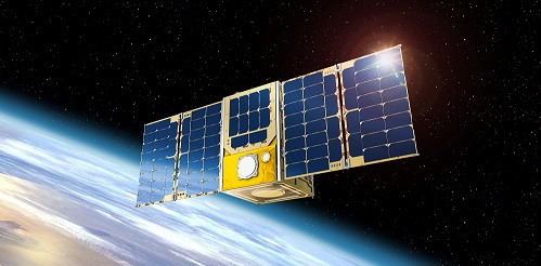
The new kid on the block is ANGELS - Argos NEO Generic Economic Light Satellites. Launched in December 2019, ANGELS A1 became operational for ARGOS data in October 2020. ANGELS is a 12U nanosatellite weighing in at only 20kg! ANGELS is important as it supports ARGOS-4, which supports even lower signal strengths further extending your transmitter's battery life. The ANGELS nanosatellite format will be used for the next 25 ARGOS satellites.
* Note: ANGELS A1 carries ARGOS-NEO (ARGOS-4 Light) instrumentation. It does not support A4 HD and does not have an A4 downlink.
The satellite instrumentation is backwards-compatible. ANGELS supports ARGOS 2, 3 and 4. The METOP satellites support ARGOS 2 and 3.