What is GPS RTK?
Real Time Kinematics
RTK is short for real time kinematics. A GPS receiver capable of RTK takes in the normal signals from the Global Navigation Satellite Systems along with a correction stream to achieve 1cm positional accuracy. GNSS includes satellites from GPS (USA), GLONASS (Russia), Beidou (China), and Galileo (Europe). On top of these signals an RTK receiver takes in an RTCM correction stream and then calculates your location with 1cm accuracy in real time. The rate varies between receivers but most will output a solution at least once per second; some receivers can output this higher precision solution up to 20 times a second. RTK capable GPS receivers used to be thousands of dollars and were limited to professional surveyors and government groups. Thanks to science, math, and economics, RTK receivers are now less than $300.
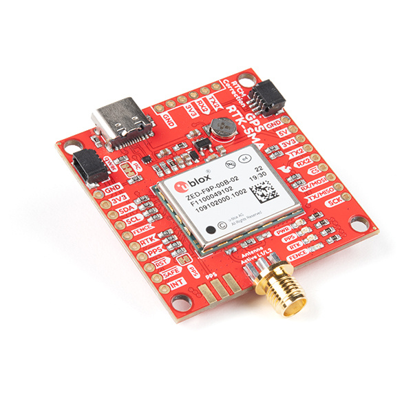
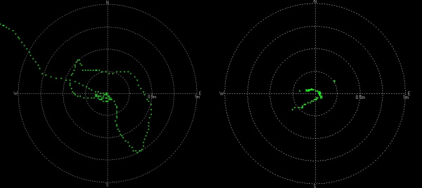
On the left we have a extremely high quality GPS receiver (the ZED-F9P seen above) with no correction data. The position wanders greatly over 1.5 meters and beyond. On the right the same receiver, with the same antenna, with RTCM correction data brings the position under 25cm with tight groupings under 10cm.
Did You Say 1 cm? Zomg How Do I Get 1 cm Accuracy!?
You'll need a GPS receiver capable of receiving and incorporating the RTCM correction data into its location solution. You’ll also need a source of RTCM correction data. This usually comes from an internet connection or a long distance radio capable of approximately 500 bytes per second. LoRa and LTE-CAT M1 are superb choices for this backhaul.
Once it's all setup and working, the rover GPS module will output normal NMEA sentences but with really accurate lat and long. To be clear, it’s not 1cm precision; it's 1cm accuracy. The precision is 0.1mm!
1 cm accuracy is also possible with a few lower cost receivers (such as the NEO-M8T) by capturing raw streams from the GPS satellites and then post processing the logs with an open source program called RTKLIB. This is handy for applications like aerial photography and agricultural inspection where alignment is important after the fact. It's also possible to tether a lower cost receiver (such as the NEO-M8T) to a laptop and run RTKLIB in unison and achieve real time solutions but this is a rather large, power hungry setup that is not ideal for embedded mobile applications. In these tutorials we will be focusing on real time (RTK) capable receivers.
